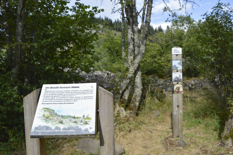
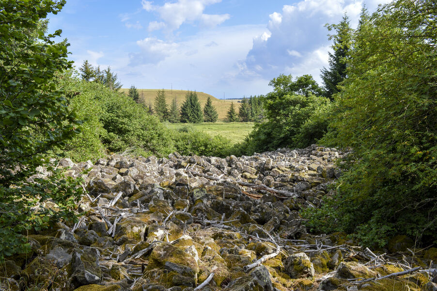
La roche de Landeyrat
Add to my favorites

Route opened
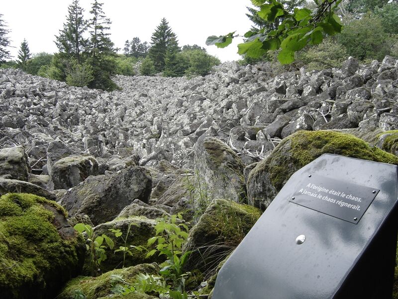
At Landeyrat, we take the opportunity to ride the vélorail, then wander through the estives and around the peat bogs, passing through the basaltic chaos, not forgetting the Roche d'Apcher - a great program!
The characteristics of the route.
Landeyrat (15)
- Distance 7.2 km
- Elevation gain 150 m
- Elevation lost 150 m
- Min. elevation 1061 m
- Max. elevation. 1149 m
- Duration (depending on pace) 2h15
- Marking Yes
Marking : Yellow markings.
No mountain bikes allowed.Equipments : Car park, Free car park, Good plans : -For your safety, please check the weather forecast before setting off on your hike. -To preserve the environment in which you are located, please avoid leaving garbage in nature. -Remember to take the appropriate equipment for the weather conditions and the hiking itinerary (hiking boots, water bottle, cap, sunglasses, jacket...).Admission fee : Free access.Opening : All year round.
Subject to favorable weather.
Report a problem Add a comment
Website Pdf file Pdf file
Add your time and share your feelings
Services nearby
Gîte les Ruisseaux
Landeyrat
Bargy Christian
Landeyrat
Vélorail du Cézallier
Landeyrat

Le Wagon des Estives
Landeyrat
B&B - Ferme des Prades
Landeyrat


Information updated on 2022-05-20 by Hautes Terres Tourisme


Contact Carladès area
Carladès Tourist Office
Avenue A. Mercier
15800 Vic-sur-Cère
Tel. 04.71.47.50.68
Carladès Tourisme
tourisme@carlades.fr
![]()
Contact Hautes Terres area
Hautes Terres Tourist Office
Pl. Hôtel de ville - 15300 Murat
Tel. 04.71.20.09.47
Hautes Terres Tourisme
contact@hautesterrestourisme.fr
@hautesterrestourisme
@hautesterrestourisme


OK
Annuler